


Drone Surveys: UAV Systems
Data acquisition with aerial UAV Systems
-
Unmanned Autonomous Vehicle (UAV)
-
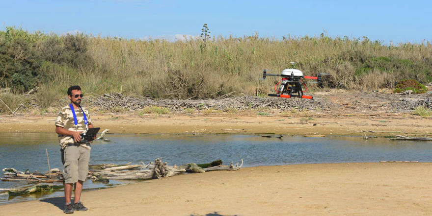
Flight session with multicopter (UAV)
-
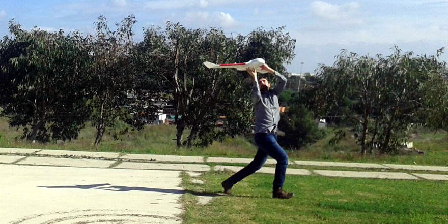
Flight session with fixed wing (UAV)
-
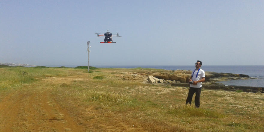
Flight session with multicopter (UAV)
-
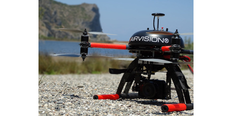
NT 4C multicopter
Remote Survey System are basically represented by aerial and marine self-motor vehicles able to follow planned tracks autonomously acquiring a wide range of geophysical data. Studio Geologi Associati T.S.T. works with both aerial Unmanned Autonomous Vehicle Systems and marine submersible Autonomous Underwater Vehicle Systems.
Aerial Unmanned Autonomous Vehicle (UAV) Systems
Unmanned Autonomous Vehicle Systems are composed by a Ground Control Station that manages aerial vehicles able to conduct complex missions autonomously. They have enough payload to carry HD visible/infra-red cameras mounted on motorized supports that keep them stabilized on the best position for survey. These features, together with the ability of the aerial vehicles to flight very close to the ground, let the UAV Systems to acquire very high resolution data.
Studio Geologi Associati T.S.T. owns various UAV professional systems both Multirotors and Fixed wings, and it is recognized by the Italian Civil Aviation Authority as qualified operator for technical survey with aerial drones.
Aerial vehicles are divided into:
- Multirotors characterized by propulsion acting in the orthogonal direction to the ground and by a very stable flight also in windy conditions;
- Fixed Wings characterized by propulsion acting in the parallel direction to the ground and that are able to fly faster than Multirotor, covering wider areas of survey.
UAV pilots of the Studio Geologi Associati T.S.T. collected more than 100 hours of operative missions, performed in several scenarios and are involved into a continuous training that maintain the pilots to keep the best professional profile, and, at the same time, provides a regular and constant maintenance to the aerial vehicles which, as a consequence, are always efficient and reliable in every conditions.
-
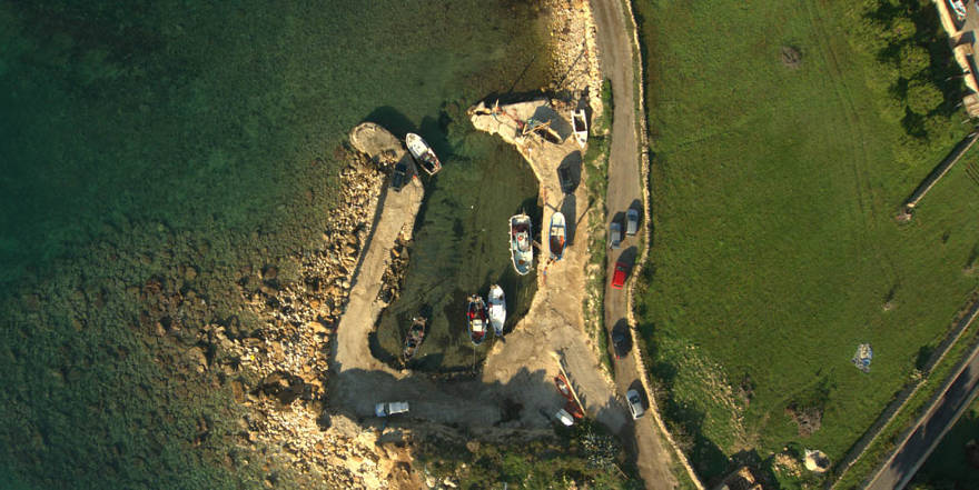
Georeferenced orthophotos with high spatial resolution
-
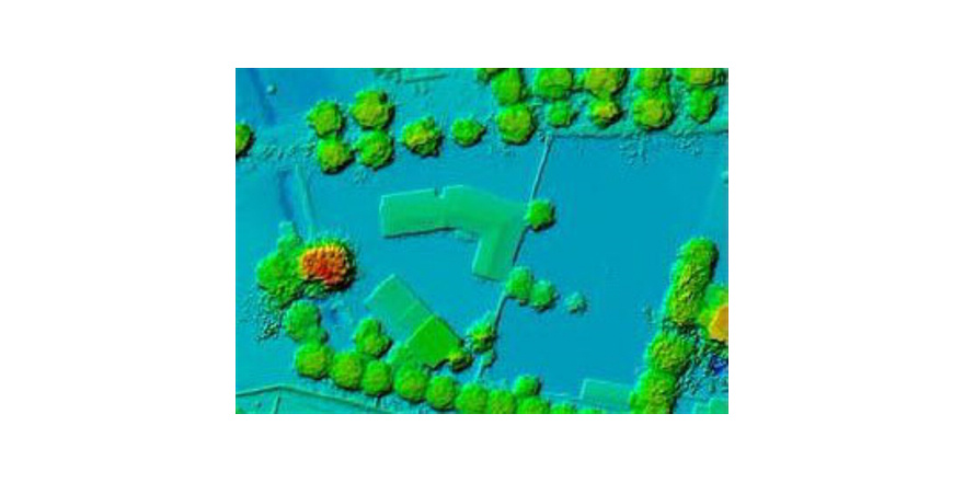
Digital elevation models (DEM) with high resolution
-
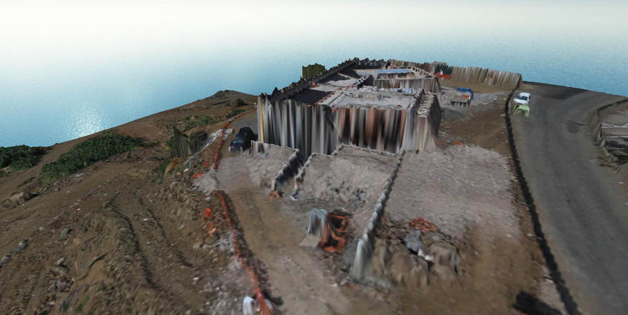
3D reconstruction of structures
-
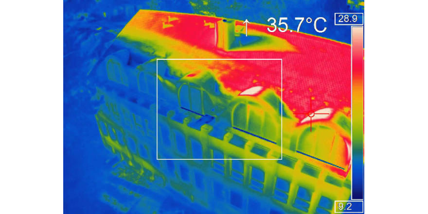
High-resolution georeferenced thermal images