


Drone Surveys: AUV Systems
Data acquisition with marine submersible AUV Systems
-
Autonomous Underwater Vehicle (AUV)
-

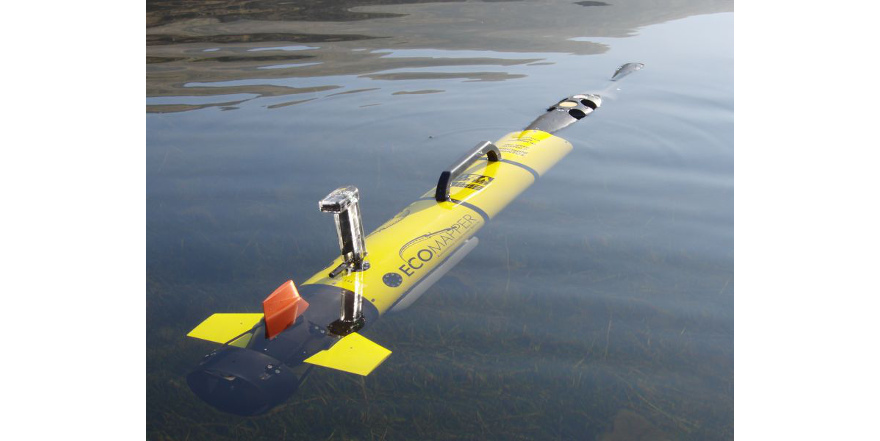
YSI EcoMapper
-
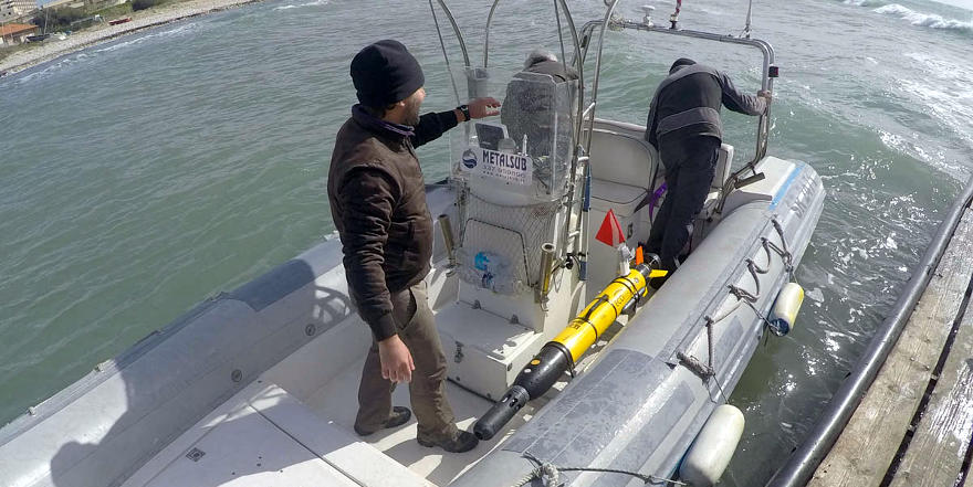
Use of YSI EcoMapper with small boats
-
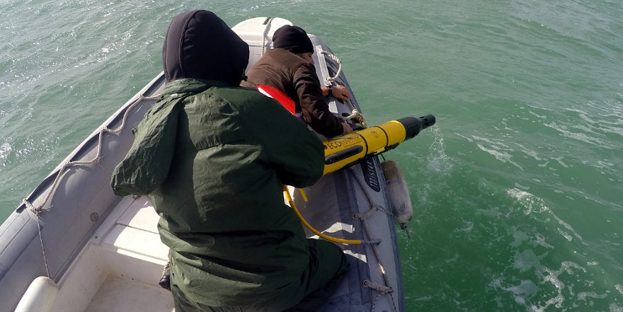
Use of YSI EcoMapper with small boats
-
YSI EcoMapper
Remote Survey System are basically represented by aerial and marine self-motor vehicles able to follow planned tracks autonomously acquiring a wide range of geophysical data. Studio Geologi Associati T.S.T. works with both aerial Unmanned Autonomous Vehicle Systems and marine submersible Autonomous Underwater Vehicle Systems.
Autonomous Underwater Vehicle (AUV) Systems
The AUV system of the Studio Geologi Associati T.S.T. is the Ecomapper produced by YSI. It is an innovative equipment for marine and environmental survey, able to perform, autonomously and simultaneously, morphological surveys of the sea bottom with a Side Scan Sonar, bathymetrical surveys with a Single Beam Echo Sounder, as well as measurements of quality, temperature and flow speed of the water column along coastal areas or lagoons, lakes, dams and rivers.
Submersible drone can access to hazardous and very busy areas acquiring data at different depth, from the surface up to 1m from the bottom. It is often used in environmental crisis scenarios such as sinking of oil tankers and container ships or spilling out of toxic contaminations.
-
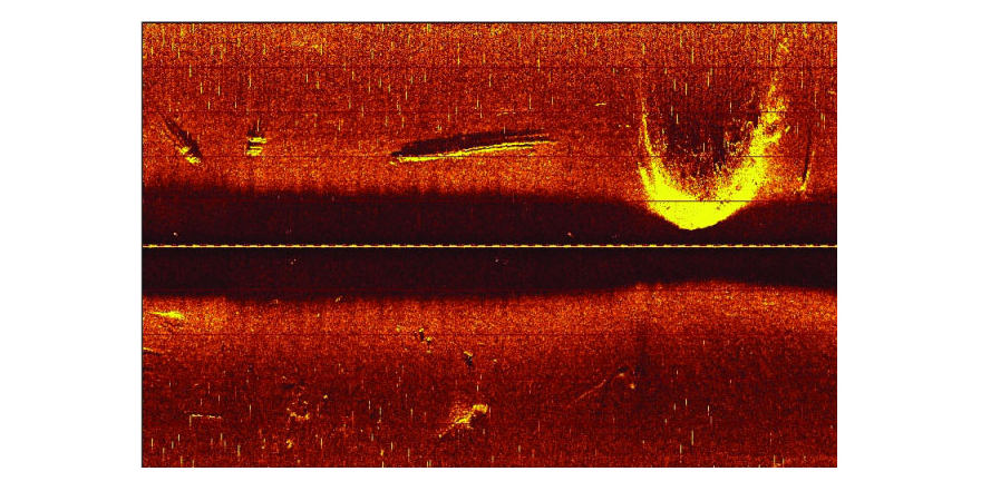
Geo-referenced high-resolution photomosaics SSS
-

High detail bathymetry
-
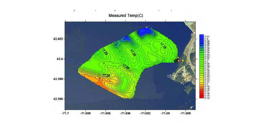
Environmental parameter
-
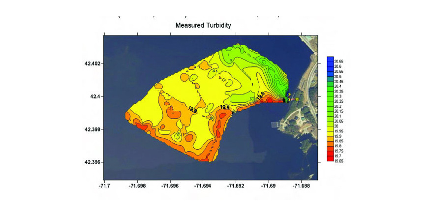
Environmental parameter
-
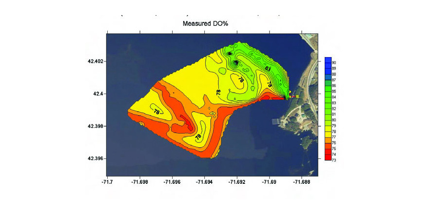
Environmental parameter